
Summer 2011
Jamestown, ND to Miles City, MT
13 June 2011
Route Map
Click on pinpoints for local information
Destination Map
Photographs and Commentary
Click on picture to enlarge
Last night we spent 8 hours under a tornado watch. A line of very strong storms that had the likelihood of forming tornadoes was coming our way. The watch area included eastern Montana (where we are now), western and central North Dakota and western South Dakota. Jamestown was on the eastern edge of the watch area. Having been though some strong storms in prior trips through this area, we were a bit concerned. I kept an eye on the weather radar at both Weather Underground and the Weather Channel. When we went to sleep, it looked like the line was going to hit us but it also looked like it was weakening in the process. A little after midnight I was awakened by thunder, lightning and heavy rain. The storm lasted about 30 minutes. We were lucky since some areas to the west of Jamestown had tornadoes touch down and others had damaging, golf ball size, hail.
This morning dawned with a partly cloudy sky and warmer temperatures. The wind only calmed down a bit, but was now coming from the west... just what we needed, a head on wind. Since there is little we can do about the weather, except talk about as I did above, we drove on to Miles City, MT. The plains in North Dakota are, in a word, monotonous. From Jamestown to Bismarck it was all relatively flat with nothing to block the wind. You do notice that many of the farm houses and barns are surrounded by trees that act as windbreaks.
Once in Bismarck we crossed the Missouri River, which was over its banks. The Corp of Engineers had been opening floodgates on dams upriver and this has caused flooding downstream. There had been heavy rains in the area for weeks and the snow melt from a deeper than normal snow pack have caused the Missouri River to reach capacity much earlier than normal. We could see evidence of the excessive rains all along our route today. Fields were flooded, highways closed and even a rest area on I-94 had to be closed because the water was blocking the entrance ramp.
Once we crossed the Missouri, the terrain changed. It was not the flat prairie we had gotten accustomed to since we left MInneapolis. It was now rolling countryside, less monotonous, but more of a challenge to drive. The headwinds and the hills combined to seriously impact our fuel consumption. Today's fuel consumption was 25% worse than the previous few days. The route took us past terrain that was reminiscent of the Badlands of South Dakota with slightly different colors and different vegetation. Some of the areas of interest along the route were Painted Canyon, Theodore Roosevelt National Park and The Little Missouri National Grasslands.
Not long after we crossed into Montana we had our first sighting of the Yellowstone River, which runs parallel to I-94 until Billings. The river was also impacted by the heavy rains and snow melt. It looked like it did go over its banks in spots. The Yellowstone is a tributary of the Missouri so its overflow also has an impact downstream.
We arrived in Miles City in the early afternoon and proceeded to do housekeeping chores, like laundry, which has not been done since we left home.
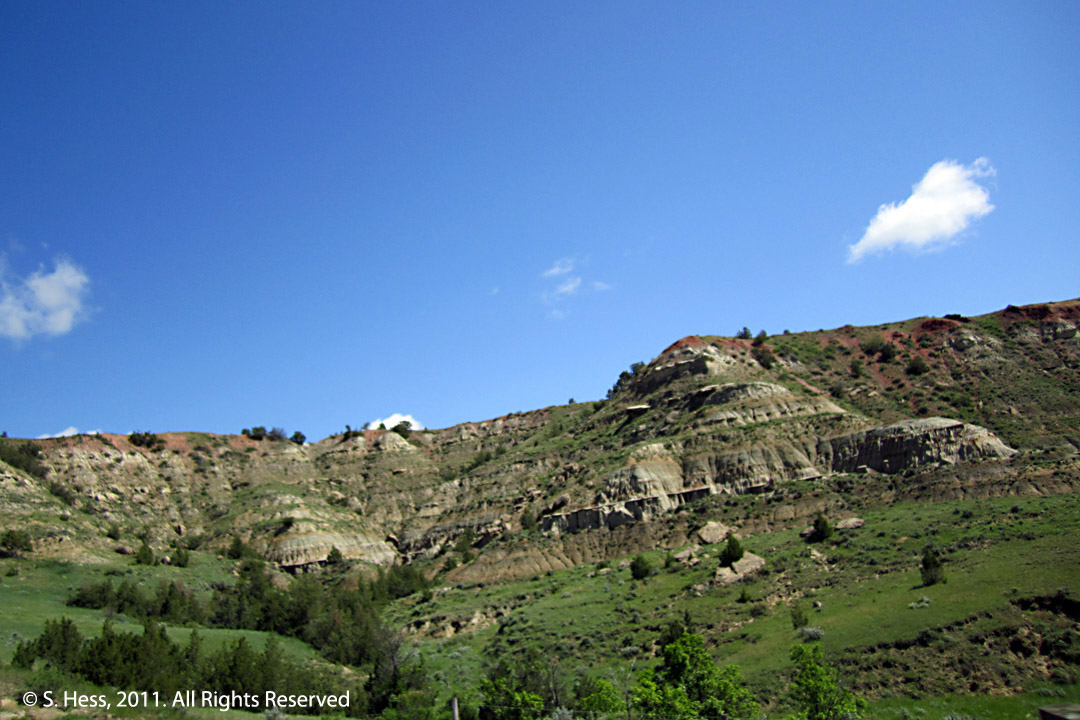
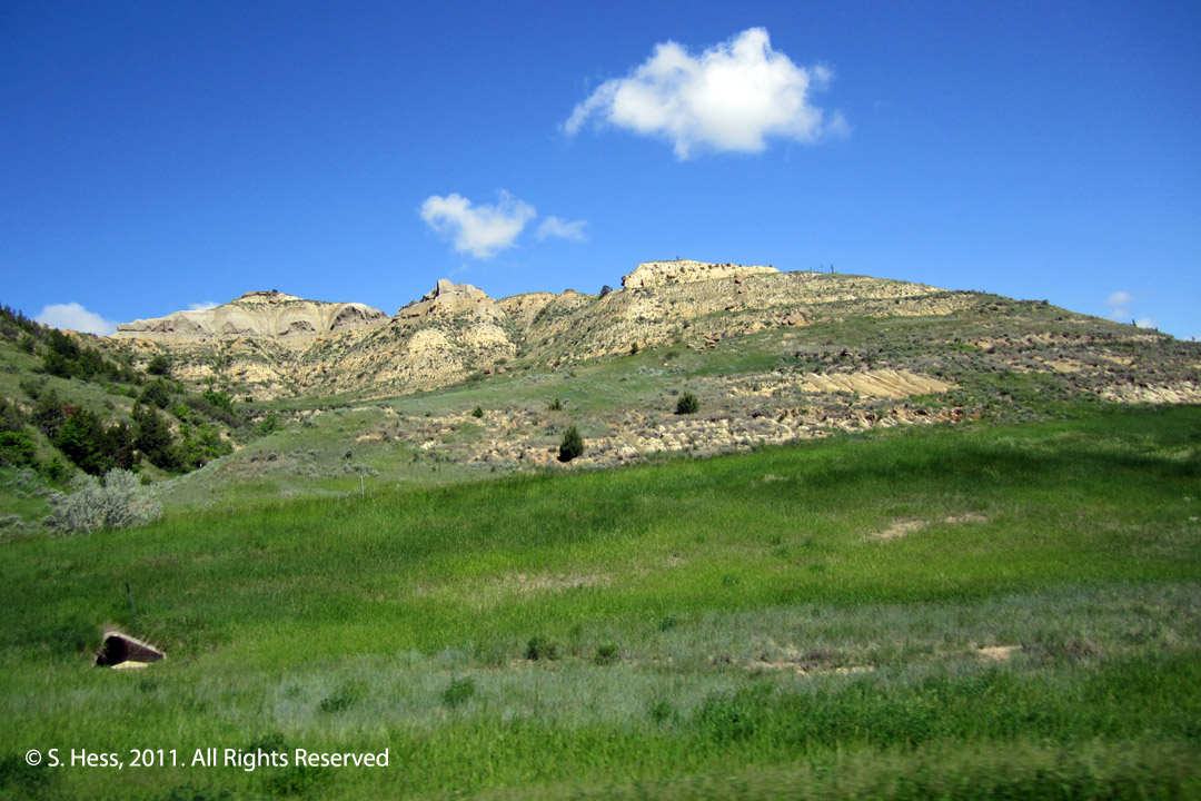
These are pictures shot by Susie as we were going down I-94 in western North Dakota. Other areas along the route are also rolling, but not as rugged and contain more grasses. These are ranch lands with cattle visible along the route.
Seen on the Road
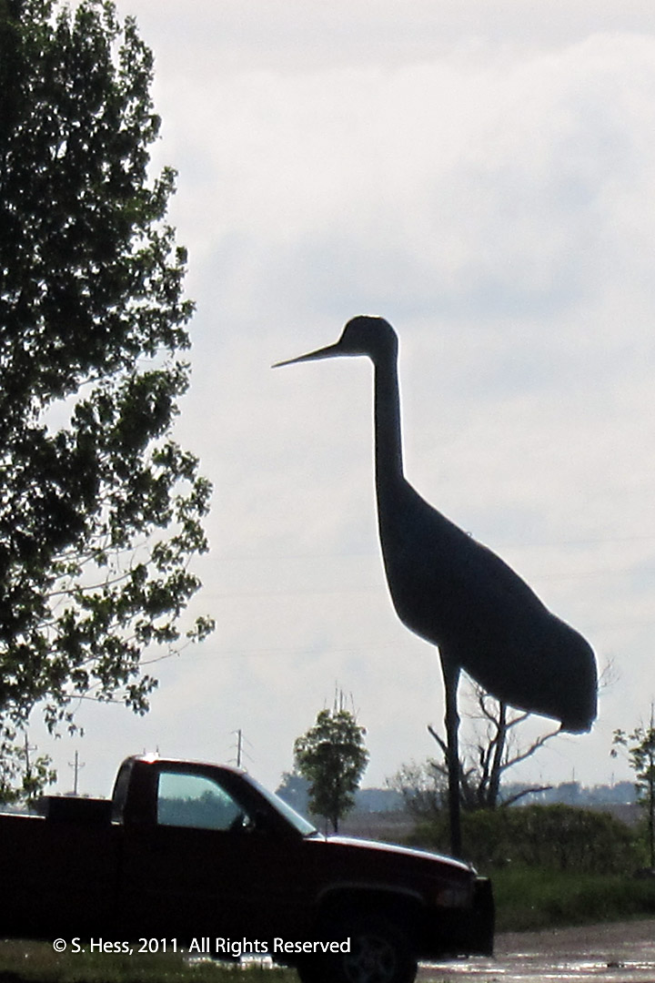
They sure grow them big in North Dakota... We had stopped to refuel at a truck stop in Steele, ND when I happened to notice this big bird looking for trucks to eat. I grabbed Susie's camera and took this shot. Unfortunately the sun was directly behind the bird, hence the silhouette.